
IOWA CITY – A road diet is a low-cost traffic management strategy that reduces the number of travel lanes present on a street to lower traffic speeds and improve the street’s overall safety. The space left by the removed lanes can be used for other public purposes such as bike lanes, transit, on-street parking, expanded pedestrian realms or street plantings. These expanded uses broaden the community value of a street, while also improving its safety and attractiveness.
The Federal Highway Administration advises in a briefing guide that road diets may reduce crashes by 19 to 47 percent, lower average speeds by 3 to 5 mph, and are appropriate for streets with an average daily traffic volume of less than 20,000 vehicles among other feasibility recommendations. Safety improvements are achieved by reducing excessive speeding incidents and eliminating potential points of conflict between vehicles and other street users.

Most commonly, road diets convert four lane streets into three lane streets with two travel lanes and a single shared turning lane. Within the last decade, Iowa City completed similar conversions for Clinton St, S 1st Ave, Keokuk St, Sycamore St, Lower Muscatine Rd, and a few others.


The following Iowa City streets are good candidates for further road diet projects as they all have traffic counts well below the federal recommendation and do not include any sections managed by the Iowa DOT. Diverting vital public space away from automobile traffic to more valuable uses will transform each of these important Iowa City corridors from roadways into community assets.
- Gilbert St
- N Dubuque St
- W Benton St
Note: traffic counts are from a 2022 Iowa DOT report.
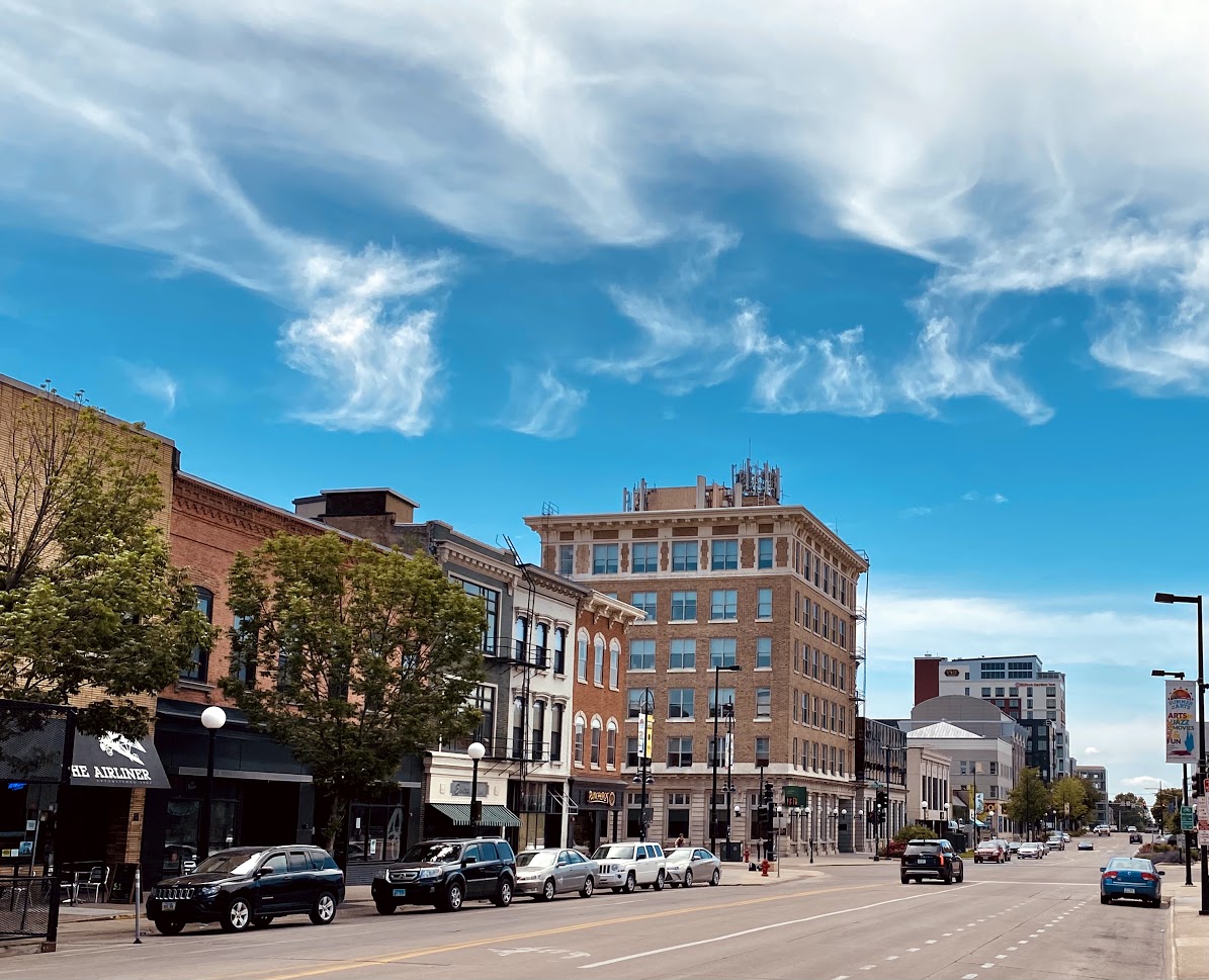
Gilbert Street
2022 Avg Daily Traffic: 11,800 at US 6

With a 2.5 mile long four lane configuration from McCollister Blvd in the South District up to E Market St in the Northside, Gilbert St is an important transportation spine in the core of Iowa City. Several bus routes including lines 1, 2, 9, and 13 utilize portions of the street within the segment, in addition to heavily trafficked pedestrian crossings at E Burlington and E Washington. A variety of commercial, residential, and civic uses front Gilbert Street providing the foundations for a dynamic urban environment. The south end of the street segment bounds the edge of the South District’s form-based zone neighborhood, which seeks to grow a walkable, human-scale community.
Two intersections along Gilbert Street ranked as high collision locations in studies conducted by the Metropolitan Planning Organization of Johnson County. A 2017 study ranked S Gilbert and E Burlington as the 6th worst intersection in Iowa City, while a 2020 study found S Gilbert and Highway 6 as the 3rd worst in the entire metro area. Reduction of lanes would lower the potential for accidents to occur by limiting the possible points for vehicles to collide when crossing travel paths through intersections.
A road diet would create valuable space for a variety of potential improvements to the roles Gilbert Street is already serving: transit lanes or dedicated bus stop treatments would enhance the street’s four bus routes; fewer vehicle travel lanes would reduce points of conflict for pedestrians crossing Gilbert Street to reach Downtown and the university; properly sized lanes would ease vehicle speed creating a safer and more pleasant frontage environment for people walking to the many commercial and civic amenities along the street; single-loaded street parking would further augment the street’s uses.

The 2014 Iowa City Downtown Streetscape Master Plan identified Gilbert Street between E Market St and E Burlington St as a candidate for a lane reduction road diet. Imagined as a “parkway” street, the plan called for the addition of bike lanes and street trees. While the city is currently executing the plan’s recommendations for S Dubuque St, it is unclear if the city intends to address Gibert St within the near future.

The segment of Gilbert Street identified in the above plan should be prioritized for any conversion project, as it currently creates a soft barrier between the residential areas to the east and heavily pedestrianized Downtown to the west. Highway 6 to Burlington St may prove trickier to build community support for a lane reduction with its higher traffic counts and role as a connection between Highway 6 and Downtown. Bicycle heat maps from the popular cycling app Strava show that despite the hostile streetscape, Gilbert remains a popular connection to Downtown from the south for bicyclists as well. Even with the presence of on-street “sharrows” intended to encourage bicycle use, the corridor is not a comfortable (nor safe) cycling environment.
The segment of Gilbert south of Highway 6 provides fewer challenges with its lower traffic counts, and the higher vehicle speeds occurring on the existing street configuration will become impactful to the planned form-based zone community. If a three-lane conversion is not feasible as a standalone project, the diet should be implemented during the next end-of-life reconstruction of the street.
North Dubuque Street
2022 Avg Daily Traffic: 12,400 south of Church Street

N Dubuque St is the primary entrance to the core of Iowa City from Interstate 80 to the north. Though traffic counts are above the federal recommendation of 20,000 daily vehicles north of Church St, the segment reaching south from this intersection to Jefferson St is an excellent candidate for a lane reduction road diet.

The segment from Church to Jefferson runs just short of half of a mile and runs parallel to N Clinton St, which successfully received a similar road diet in 2019. Community businesses, several churches, university buildings, and a mix of housing front N Dubuque St as it approaches Downtown. Iowa City’s Line 6 Peninsula bus and several Cambus routes use the street, in addition to the wide pedestrian path fronting the street’s west.
Aside from vehicle counts, the Federal Highway Administration advises that stop light frequency should be considered for the feasibility of a road diet. The only stop lights present within the N Dubuque St segment are at its Church St and Jefferson St termini, improving the possibility of any implementation. A three-lane conversion on N Dubuque St would ameliorate several issues for the street segment and the Northside neighborhood.
The southbound left lane at the Church St intersection endures queuing issues and vehicle conflicts. Crashes may occur when drivers in the left lane attempt sudden changes into the right lane to avoid stopped vehicles waiting to turn left onto Church St. A road diet would allow this lane to become left turn only improving the intersection’s safety by eliminating this conflict.
A 2017 parking analysis study completed for the Northside neighborhood found on-street parking near the university and Downtown is under pressure from competition between campus commuters and neighborhood residents. Eliminating a travel lane would allow for metered parking on one side of N Dubuque St reducing the need for campus commuters to seek parking on residential streets. Not only would the parking provide revenue for the city, the parked cars could serve as a safety buffer between vehicle traffic and the wide pedestrian path on the west side of the street.

During research and obtaining a photograph of the N Dubuque St segment, I personally experienced the difficulty pedestrians encounter crossing the street. With no stoplights between Church St and Jefferson to provide a walk signal, pedestrians must wait for an ample gap in vehicle traffic to cross safely. This wait can last up to nearly ten minutes and far exceeds the typical wait experienced at a signalized crossing. Eliminating a travel lane would not only halve the vehicle travel paths those crossing must judge, but would also allow for the installation of a pedestrian refuge island in the center lane.
Two blocks to the south of the segment Dubuque St becomes closed to vehicles at the Pedestrian Mall, while north of the segment the street transitions to a full boulevard with views of the Iowa River before it connects with Interstate 80. A road diet would more appropriately progress this transition within the context of its adjacent land uses. Calming vehicle traffic and providing additional amenities (whether pedestrian enhancements, on-street parking, or otherwise) demonstrates that the street supplements the surrounding neighborhood, rather than exclusively vehicle throughput.
West Benton Street
2022 Avg Daily Traffic: 9,900 at east bank of Iowa River

A road diet implementation on W Benton St would require more complex engineering in contrast to the other streets discussed due to its bridge over the Iowa River and the transition to one-way flow at the S Clinton St intersection. However, the segment from Riverside Dr to S Clinton St features a low traffic count and a lane reduction would create an excellent opportunity to bolster the multi-use Iowa River Corridor Trail, which follows the street’s bridge across the Iowa River.
The Iowa River Corridor Trail is a widely used bike and pedestrian route that stretches from Terry Trueblood Reservoir in the South District 18.2 miles north to the Mehaffey Bridge on Lake Coralville. While large swaths of the trail are primarily used for recreation, the portions within Iowa City and Coralville are important transportation connections for walkers and cyclists, as the trail runs through the center of the urban area with linkages to destinations on each side of the Iowa River.
W Benton St is one of the trail’s key Iowa River crossings, which allows users to move from the eastern areas of Iowa City to the Riverside Dr corridor with links to the University of Iowa Hospitals and Clinics campus. Yet, the trail’s right-of-way on the north end of the W Benton St bridge is a few feet narrower than open trail sections, restricting comfortable bi-directional movement of both cyclists and pedestrians. There is little space for additional activities the bridge could host for trail users such as passive recreation of the river environment.
City and State plans consistently voice a desire to increase engagement with the Iowa River as a natural asset for the community, showcased in investments in Riverfront Crossings Park and the Iowa River Water Trail. A three lane conversion on W Benton Street would create the necessary streetscape space to introduce bidirectional protected cycling lanes along the northside of the bridge.

Directing bicyclists away from the bridge’s existing pedestrian zone would reduce bottlenecking and speed differentials between trail users. Without these conflicts, those walking along the trail’s bridge segment would be free to enjoy views of the river, birdwatch, or move along at a leisurely pace. Pedestrian amenities (benches, lighting, etc.) could be introduced, increasing the overall utility of the bridge and trail to the community.
As previously mentioned, any road diet along this segment of W Benton St would face additional engineering and design complexities. Concurrently implementing one-way to two-way conversion of the multiple street segments encircling the county administration building would likely be prudent. Though such a major project would be further complicated as it would include re-working several intersections in the area, which would ultimately require additional engineering and impact studies.
Project Funding
It appears the city most frequently implements road diets during otherwise necessary street repairs, though not always. The city re-striped Keokuk St with a lane reduction last year absent from any major resurfacing work. Road diets tend to be relatively inexpensive infrastructure projects; the Federal Highway Administration estimates the cost per mile as ranging from $46,000 to $100,000 depending on whether additional features (bike lanes, curbs, etc.) are included in the project. The reduction of travel lanes and safety improvements often lessen the maintenance burden of a street over its life course. A variety of Federal grants are available to municipalities for implementing road diet projects:
- Surface Transportation Program (STP)
- Highway Safety Improvement Program (HSIP)
- Safe Routes to School Program
- Safe Streets and Roads for All (SS4A) Program
The last program on the list, Safe Streets and Roads for All, is an especially pertinent funding opportunity for any city undertaking road diet projects. The US Department of Transit specifically cites lane reduction conversions and improvement of pedestrian or cycling routes as eligible implementation activities under the grant. Created by the 2021 Bipartisan Infrastructure Law, the grant program holds over $3 billion in remaining funds through 2026.
The Metropolitan Planning Organization of Johnson County (MPOJC) is ultimately responsible for the planning and funding applications for the street segments discussed in this post, as each is a part of the arterial streets plan. While the MPOJC 2024 work plan indicates that the organization is evaluating previous road diet projects, there is no indication of planning or implementation of new four to three lane conversions.